

How Many Steps to the Padar Island Viewpoint?

Last updated: 23 August 2026

Hiker climbing a wooden staircase trail up the grassy savanna hillside on Padar Island
Hiker climbing a wooden staircase trail up the grassy savanna hillside on Padar Island. Photo: Wayan Parmana/Unsplash.

The Padar Island viewpoint hike has roughly 800–840 steps on a constructed wooden-and-concrete staircase — there is no single official count published by the park authority, but independent operator and guide counts cluster inside that range. The climb gains about 170-270 meters of elevation over a one-way distance of roughly 0.7-1.5 km, and takes most visitors 25–45 minutes up and 20–30 minutes down.

Why the Step Count Varies by Source

Every number you’ll see quoted online — 750, 780, 800, 815, 830, 838 — comes from an operator’s own count or a guide’s estimate, not from an engineering drawing or an official park sign. Komodo National Park has not published a definitive step count, and different counts likely reflect counting from slightly different start points (the beach vs. the jetty), different endpoints (the first viewpoint deck vs. a higher ridge point), and simple human variation in counting a staircase that isn’t uniform. The most defensible, source-checked range for a 2026 guide is about 800–840 steps to the main three-bay viewpoint — treat any single “exact” number you see elsewhere as one operator’s count, not a verified official figure.

Old Dirt Trail vs. New Staircase

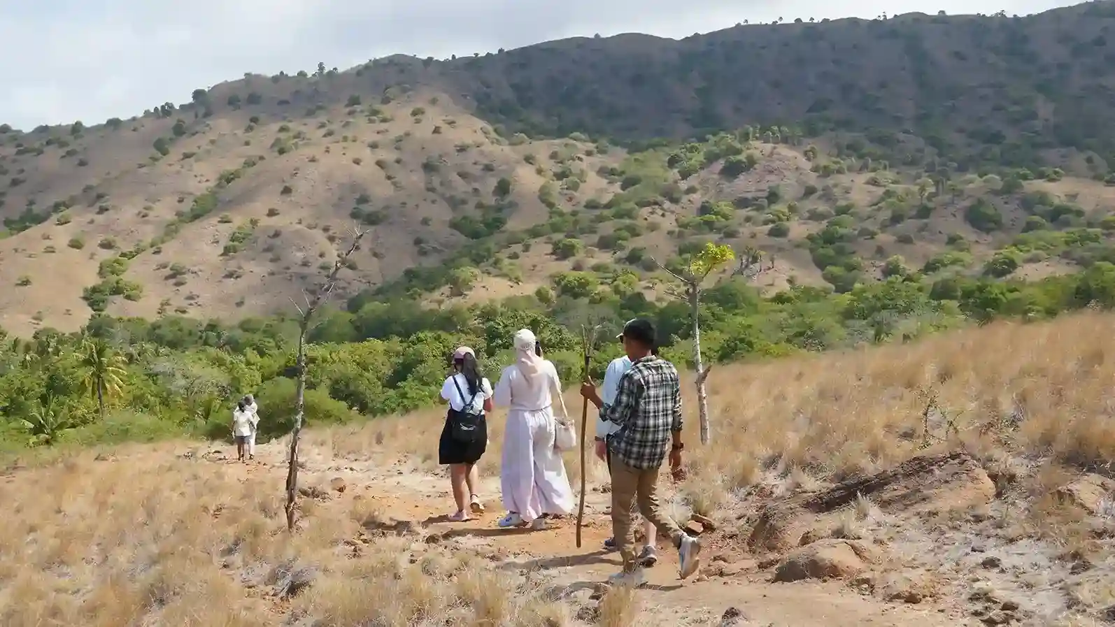
Visitors walking along the grassy trail toward the viewpoint on Padar Island
Visitors walking along the grassy trail toward the viewpoint on Padar Island. Photo: Wayan Parmana/Unsplash.

Before roughly 2018, the route to Padar’s viewpoint was a loose dirt-and-rock path, steeper and more erosion-prone than what exists today. Concrete and wooden steps were installed starting around 2018 and have been progressively improved through 2024–2025 to reduce erosion and improve footing. The result is a genuine staircase for nearly the entire ascent, though hikers still report some sections near the top with irregular step heights and a rougher, more trail-like surface rather than uniform stairs — the upgrade replaced most, but not all, of the original loose path.
Trail Breakdown by Segment

Generic line illustration of a hill elevation profile, with no figures
Generic line illustration of a hill elevation profile, representing the idea of ascent per trail segment.
SegmentApprox. stepsWhat to expect
Landing to first rise~150–200Gentler start, still mostly flat ground and early steps
First rise to midpoint platform~250–300Steeper section; most hikers slow down here; a natural rest point
Midpoint to upper ridge~250–280Continued steady climb, less shade than the lower section
Upper ridge to main viewpoint~100–150Final push, often the most exposed to direct sun

These segment figures are approximate and drawn from operator and guide descriptions of the route’s natural rest points rather than an official trail map — the total across segments lands within the overall 800–840 range.

Where the Rest Points Are

A hiker standing on the rocky summit ridge of Padar Island looking at the view below
A hiker standing on the rocky summit ridge of Padar Island, one of the popular rest points along the trail. Photo: Wayan Parmana/Unsplash.

The staircase has a small number of natural pause points — a wider platform roughly a third of the way up, and a second flatter section closer to the top before the final push to the main viewpoint deck. Neither is a formal “station” with facilities; both are simply wider or flatter sections of the built staircase where hikers commonly stop to catch their breath or take a photo looking back down at the bay.

How Long Does the Hike Take?

PaceTime upTime down
Fit, fast pace~20–25 minutes~15 minutes
Average pace with photo stops~30–45 minutes~20–25 minutes
Slower pace, families, frequent breaks~45–60 minutes~25–30 minutes

How Difficult Is It, Really?

Moderately difficult — short in distance but steep, hot, and shade-free for essentially the entire climb. It is manageable for most reasonably fit adults without hiking experience, but the combination of continuous stairs and tropical heat (especially outside the early morning window) makes it more physically demanding than its short distance suggests. It is not a technical hike — there’s no scrambling, exposure, or route-finding — the difficulty is almost entirely cardiovascular and heat-related.

Who Should Think Twice Before Attempting the Hike

Anyone with significant cardiovascular or joint conditions, uncontrolled heat sensitivity, or a fear of heights on open, railing-light staircases should discuss the climb with their doctor or trip operator before committing to it as part of a fixed itinerary. Because there is no shortcut or turnaround point that avoids the exposed sun once you’re partway up, and no shaded rest area to wait out heat, this is a hike where a realistic self-assessment before boarding the boat matters more than most other stops on a typical Komodo itinerary. Pregnant travelers, anyone recovering from a lower-body injury, and very young children are the groups operators most often flag for a slower, more supervised pace rather than outright exclusion — the climb is achievable for many of them with extra time and rest stops, but it should be a deliberate choice, not a surprise made at the base of the stairs.

How the Staircase Compares to Other Komodo National Park Trails

Padar’s climb is shorter and steeper than the dragon-trekking routes on Komodo and Rinca, which are longer, flatter, and shaded in more sections but involve a guided walk at a ranger’s pace rather than a self-timed stair climb. Where Komodo and Rinca trekking difficulty depends mostly on distance and heat exposure spread over an hour or more of walking, Padar concentrates nearly all of its physical demand into a single continuous 25–60 minute stair climb, making it a fundamentally different kind of “moderate” difficulty rating — shorter in duration, more intense in the moment.

What Changed Since the Staircase Was Built

Visitor reports and guide descriptions from before the roughly 2018 staircase installation describe a noticeably harder, more erosion-damaged dirt trail with looser footing throughout, closer to a genuine scramble in the steepest sections. The built staircase reduced the risk of slipping on loose rock and shortened effective climbing time for most visitors, even though the total step count feels similar to older step estimates because the staircase largely follows the same route the dirt trail once took. In other words: the path hasn’t gotten shorter, but it has gotten safer and more predictable underfoot.

Tips for an Easier Climb

  • Go at sunrise. Temperature is the single biggest difficulty multiplier on this hike, and early morning is meaningfully cooler than a midday climb.
  • Pace using the natural rest points, not a fixed time target — the staircase’s wider platforms are there for a reason.
  • Wear closed-toe shoes with grip. Some sections retain uneven or irregular step heights even after the staircase upgrades.
  • Carry more water than you think you need. There is no water source on the trail.

Padar Island Viewpoint Hike: Quick FAQ

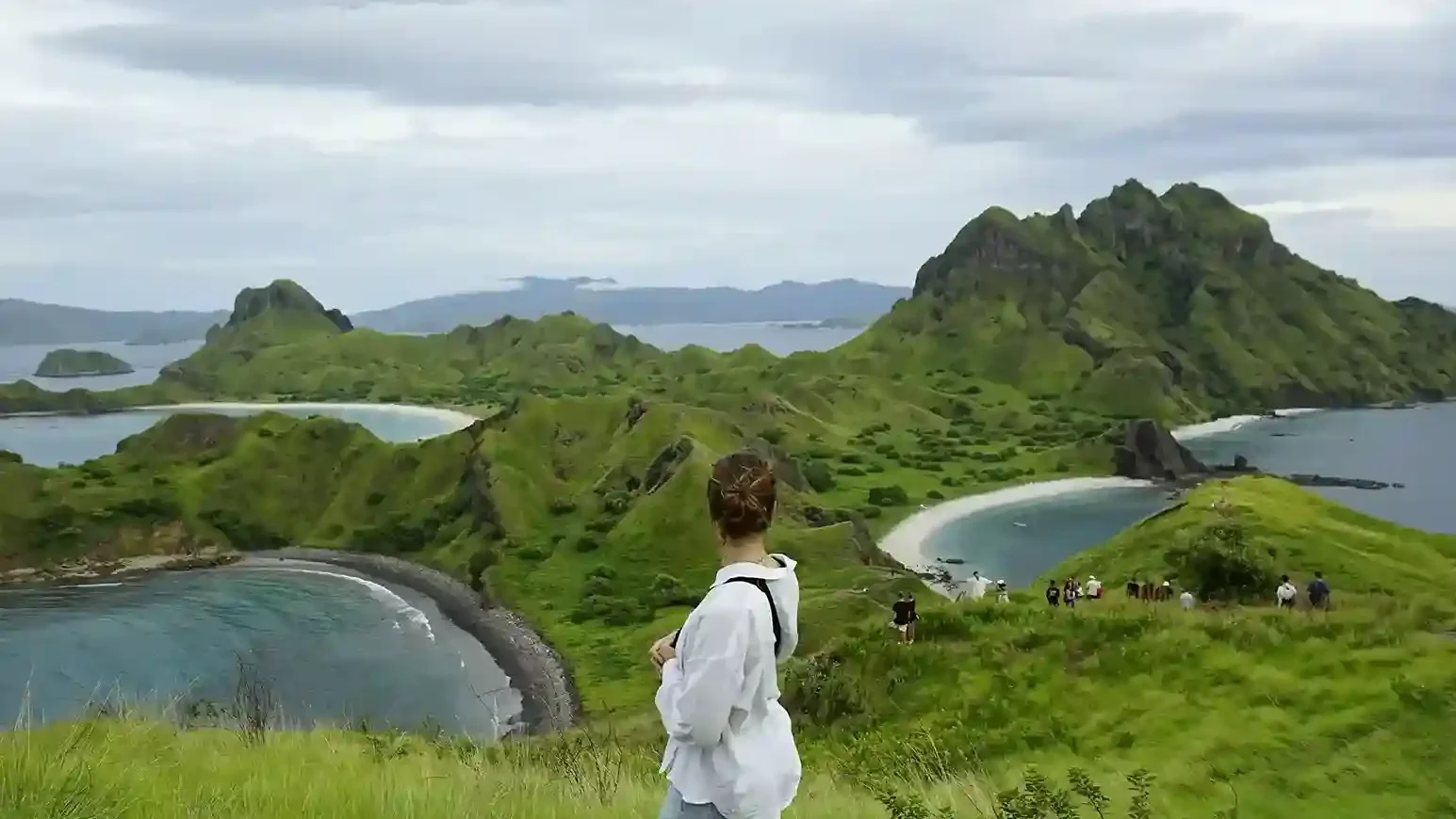
A visitor standing on a rocky outcrop on Padar Island's ridge, looking out over a curved bay and the island's peaks
A visitor standing at the summit of Padar Island looking out over the three bays — the payoff at the end of the stair climb. Photo: Killian Pham/Unsplash.

How many steps are there to the Padar Island viewpoint?

Roughly 800–840, based on a cross-check of independent operator and guide counts — there is no official published count from the park authority as of August 2026.

Is the Padar Island hike difficult for beginners?

It’s manageable for most reasonably fit beginners but should not be underestimated — the continuous stairs and lack of shade make it more demanding than its short distance suggests.

How long is the Padar Island hike?

About 0.7–1.5 km one-way to the main viewpoint, roughly 2–3 km round trip, with 170-270 meters of elevation gain.

How many steps are on Padar Island’s trail?

Roughly 800–840 steps according to counts from various operators and guides; no official figure has been published by the park authority.

Is there shade on the Padar Island staircase?

No — the climb is almost entirely exposed to direct sun, which is the main reason operators schedule it at sunrise rather than midday.

Can you skip the hike and still see the view?

Not the classic three-bay viewpoint — it’s only visible from the top of the staircase. Some of the bay shape is visible from the boat on approach, but it isn’t the same framed view most Padar photographs show.

For the full trip-planning picture beyond the hike itself, start with the Padar Island travel guide. For what else to do once you’re at the top, see things to do on Padar Island, and for footwear and gear recommendations, see the Padar Island packing guide.

Steps counted, boat still to book

This is a research page and issues no tickets. Departures are operated by our affiliated partner, Komodo Luxury. Trail difficulty is fixed; the only lever you have over how hard the day feels is what time your boat reaches the dock. Departures to compare on timing: Komodo sailing trips, Labuan Bajo tours, and private-trip packages.

How many steps, and how steep

Roughly 800 to 840 steps from the jetty area to the main viewpoint. There is no official figure, and counts differ because some stair runs merge into sloping ramps and because people disagree about whether to include landings and short connectors. Independent counts cluster in that range, which is close enough for planning. Expect a few hundred in the gentler first half and a few hundred more in the steeper upper section; short spurs to the side terraces add a handful without changing the picture.

The climb rises about 170 to 270 metres over less than two kilometres, which is consistently steep but short. Because it is broken into flights and terraces, it reads more like a long stairwell than a mountain path — steady ascent with only brief near-level landings until the ridge. The lower half has broader, shallower steps; the upper flights are steeper and more closely spaced, and the short dirt connectors between stair segments near the top can feel slippery when dusty or after rain.

Rated for a fit adult it is easy to moderate. It becomes genuinely hard if you are unused to stairs or to heat. There is no technical scrambling and the route is obvious; the unshaded gradient and the humidity are what do the work. Most people walk up in 25 to 45 minutes and down in another 20 to 30, depending on fitness, crowding and photo stops, with groups including children or older relatives allowing more.

The trail starts directly inland from the main jetty, at a signed gateway by the ranger shelter behind the information boards. Groups assemble there for the ticket check and safety briefing, then step straight onto the staircase — there is no gradual approach. On-site you will find simple schematic maps near the ranger post showing the staircase line and the main terraces, but no topographic detail, and operators sometimes share basic route sketches in their trip materials. You do not need either.

The treads are a mix of wood and concrete with handrails on many but not all stretches, and loose gravel or sand accumulates on them, especially after a busy session. Closed footwear with real tread is the practical requirement.

If heights make you uneasy

Most visitors with a mild to moderate fear of heights cope well here, because the exposure is visual rather than a sheer drop. The staircase is wide, terraced and railed on the steeper stretches, which reduces the sense of exposure considerably compared with an open rocky path. Compared with Bali’s Diamond Beach stairs, Padar’s are wider, more regular and less carved into a cliff face, which most people find reassuring — though Padar asks for more sustained elevation.

The techniques that work are simple: focus on the steps immediately ahead, stay on the inner side of the staircase, and set a conservative turnaround point before you start rather than deciding under pressure. Tell your guide you are uneasy, so they know not to push you higher and can choose less exposed spots for photographs. Rangers are already working to keep people on the staircase, discourage edge posing and manage crowding at the narrow points, so they are on your side in this.

The boat is a separate anxiety and worth naming. Reaching Padar always involves a crossing; a larger, more stable vessel and a calmer time of year both help, and the run from Labuan Bajo is short by regional standards. Many people find the boat leg harder than the climb precisely because it is passive — the trek is entirely within your control, and only demands cardiovascular effort and heat tolerance.

Heat, families and reporting problems

August sits in the dry season with strong sun, almost no shade and a dry brownish landscape, and it feels hotter than the air temperature suggests because rock and steps radiate heat back at you. Humidity is lower than in the wet season, but the combination of sun and exertion means heavy sweating on the staircase. An early session, water, a hat and light clothing are the whole answer, and the conditions are typically windy as well.

Families hike this routinely, with the caveat that adults supervise closely — particularly near gaps in the railing and on the final dirt spurs. Setting clear rules in advance about staying on the inside of the path and not running is more effective than issuing corrections halfway up.

There are no special written rules for older hikers, but rangers encourage realistic pacing and turning back if anyone is struggling. Use the railings, avoid the hottest hours, and treat a mid-level terrace as a legitimate destination.

Trail running is strongly discouraged for the same reasons it is impractical: the staircase is busy, surfaces are sandy or damp, and the railings were not designed for speed. Rangers expect visitors to walk and stay in the flow.

Any accident or medical problem should be reported immediately to the on-duty rangers at the trailhead area. They coordinate first aid, arrange the boat return and can contact further assistance. That is the mechanism, and knowing where it starts is worth the ten seconds it takes to notice the ranger post on your way past.

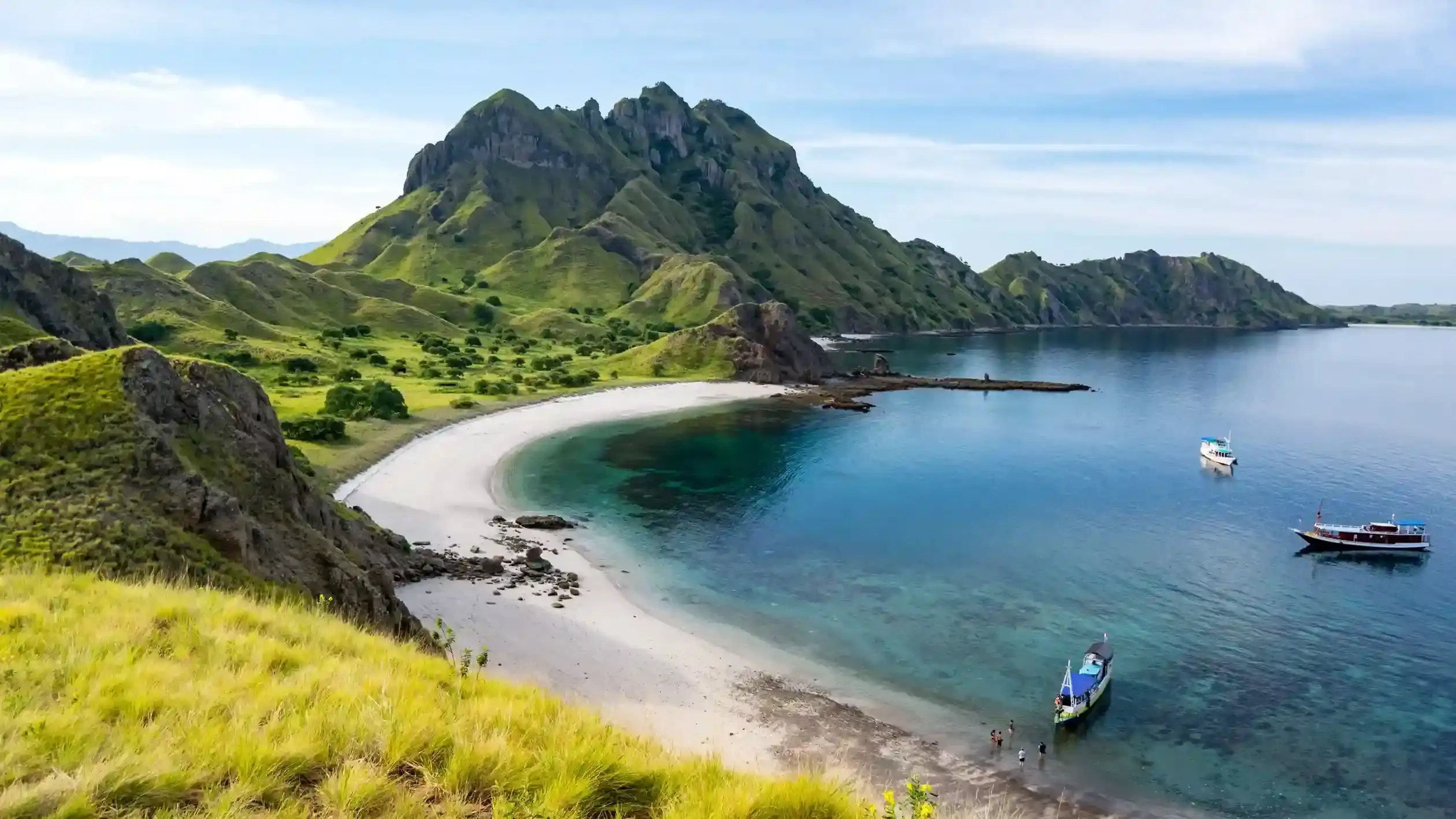
One factual note while you are up there: Padar is known for the three distinct bays visible from the main ridge, each with a different sand tone. From the viewpoint you can also pick out smaller coves and rocky inlets, but visitor boats use the central bay and the three are what the panorama is about.

This guide does not operate boats. Bookings are fulfilled by Komodo Luxury, and this site may earn a referral commission.

Interactive · the climb, stage by stage

Trek explorer: the Padar viewpoint climb

The walk from the ranger jetty to the three-bay viewpoint is short but entirely unshaded. Pick the pace that describes your group and the stages below re-read themselves.

Your pace
Up to the viewpoint
Back down
Distance, one way0.7–1.5 km
Stepsroughly 800–840
Elevation gainroughly 170–270 m
Shade on the trailnone

    The park publishes no official step count; the 800–840 range is where independent operator counts cluster. The elevation gain is also the viewpoint's height above sea level, because the trail starts at the beach. Daily highs around Padar sit at roughly 28–33 °C and the open staircase radiates hotter than the air. There is no clinic and no medical facility on the island — rangers and crews carry basic first-aid supplies only. Read the hike, steps and difficulty · the route in detail · kids, seniors & non-swimmers · rules, rangers & safety.

    Scroll to Top
    Book with Komodo Luxury →
    💬

    Additional photo credits on this page: Killian Pham, Wayan Parmana on Unsplash.