

Journal
The Ultimate Guide to the Padar Island Hike Route
The air on an early Padar approach is cool, still holding the memory of night, and a salt-laced breeze drifts across the deck as the engine cuts to a low thrum.
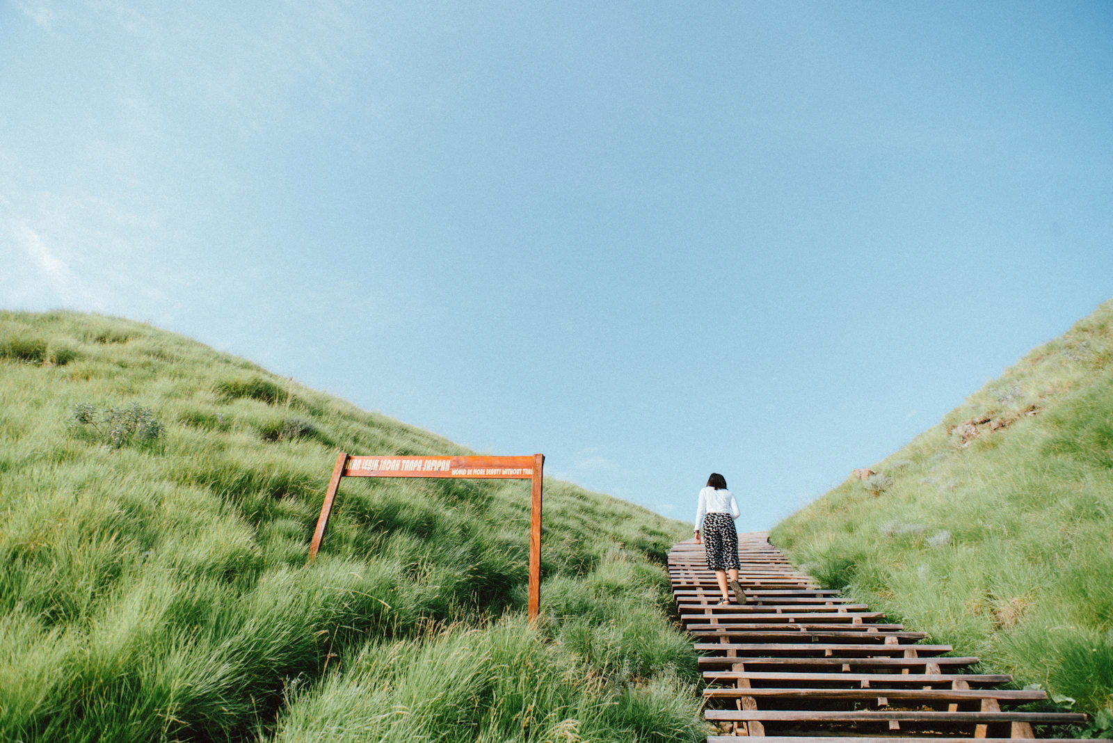
- Trail Type: Man-made stone staircase with approximately 800–840 steps (no official count published).
- Elevation Gain: Roughly 170–270 m (560–885 feet), the spread reflecting which of the island’s three viewpoints is measured; no official park survey has been published.
- Average Time: 25-45 minutes to ascend at a moderate pace.
The air on an early Padar approach is cool, still holding the memory of night, and a salt-laced breeze drifts across the deck as the engine cuts to a low thrum. Silhouetted against a sky blushing with the first hints of dawn is the dragon-like spine of an ancient volcano. This is Padar, and its famous summit calls. The rock of the tender against the floating jetty is the only sound, a percussive welcome. Stepping onto the island, the ground feels solid, primordial. The wooden signpost marks the beginning of the path, the start of an ascent that has become a pilgrimage for the world’s most discerning travelers. The journey up the Padar Island hike route is not just a walk; it is an immersion into one of the planet’s most unique and starkly beautiful landscapes.
Deconstructing the Ascent: What to Expect on the Trail

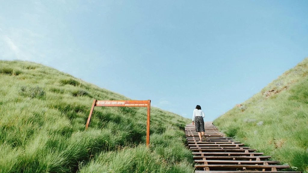
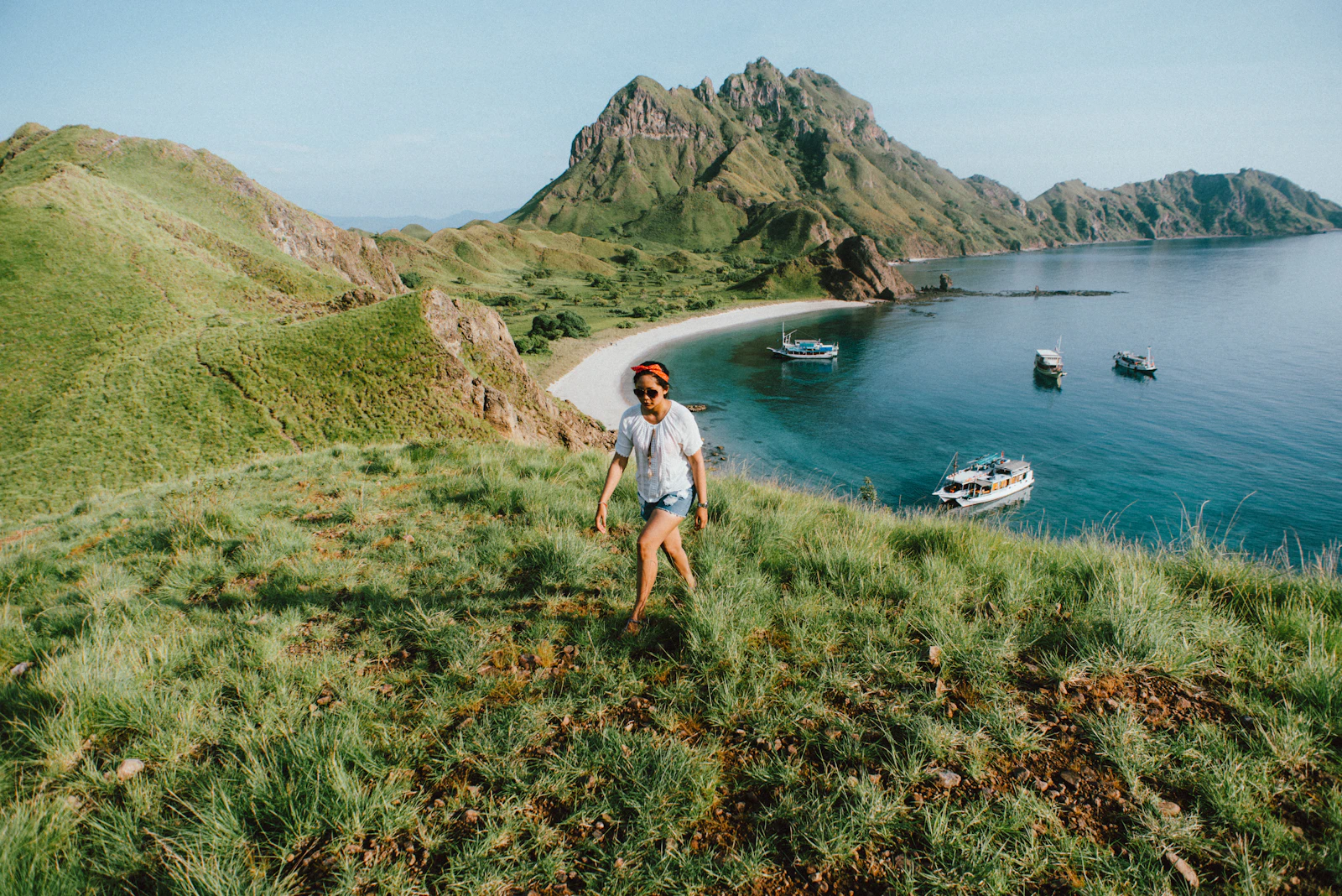
The trek to Padar’s summit is a clear, singular path, thoughtful park management. Your journey begins at a simple floating dock where your boat will moor. After a brief check-in with the park rangers, who maintain a small post here, the trail commences. The initial 100 meters are a gentle, dusty incline, allowing your body to acclimate to the effort ahead. This section gives way to the primary feature of the hike: a rugged but well-constructed stone staircase. Installed around 2018 to combat trail erosion and improve visitor safety, the staircase comprises approximately 800–840 steps (no official count published). This is the core of the physical challenge. The steps are uneven in height and depth, demanding concentration. There are several strategic rest points along the way—flattened earth plateaus that serve as preliminary viewpoints. The first major one, roughly a third of the way up, offers a tantalizing preview of the coastal panorama below. It is worth pausing here, not just to catch your breath but to take in the changing perspective before the final push to the summit.
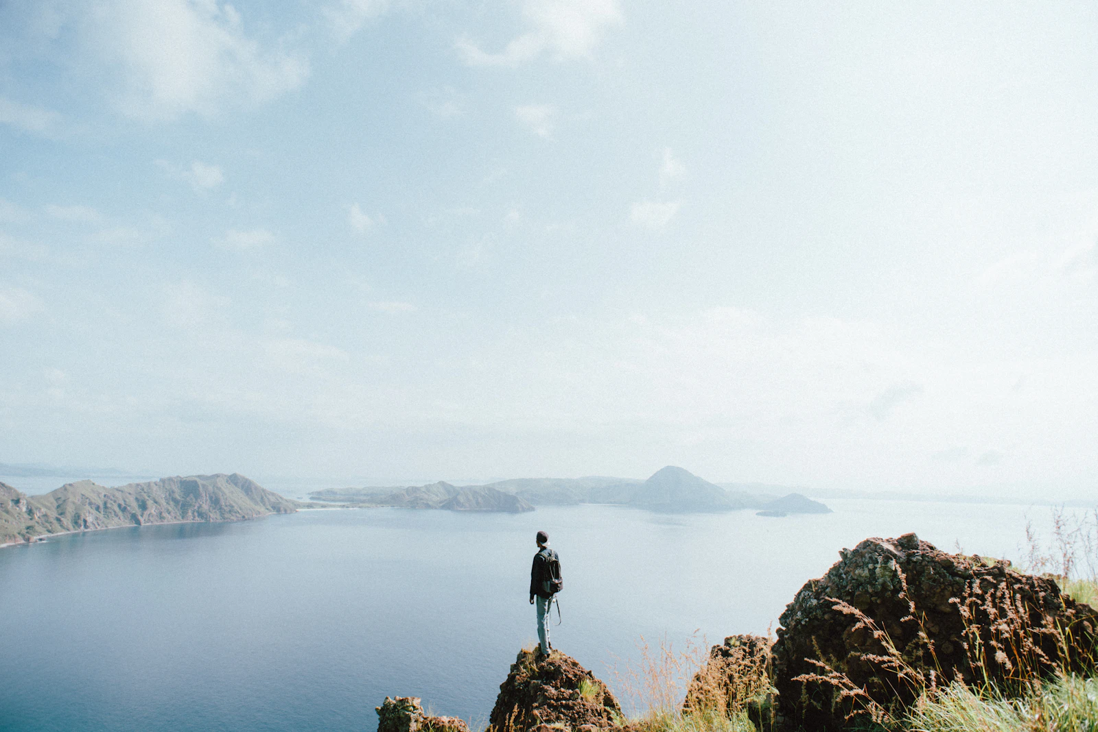
The terrain is arid, dominated by dry grasses and hardy Lontar palms, which rustle in the wind. The volcanic soil is loose underfoot if you step off the main path, so sturdy footwear is essential. The entire ascent, while only 0.7-1.5 km in length, involves a significant vertical gain of roughly 170–270 m, making every step a deliberate effort against gravity.
The Tri-Beach Panorama: A Geological Marvel from the Summit
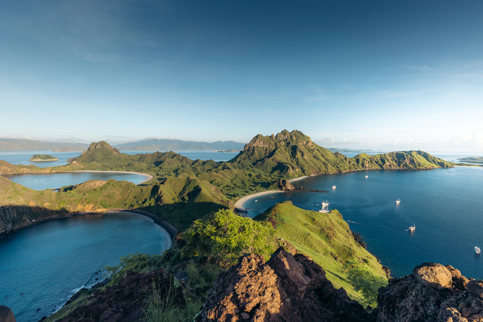
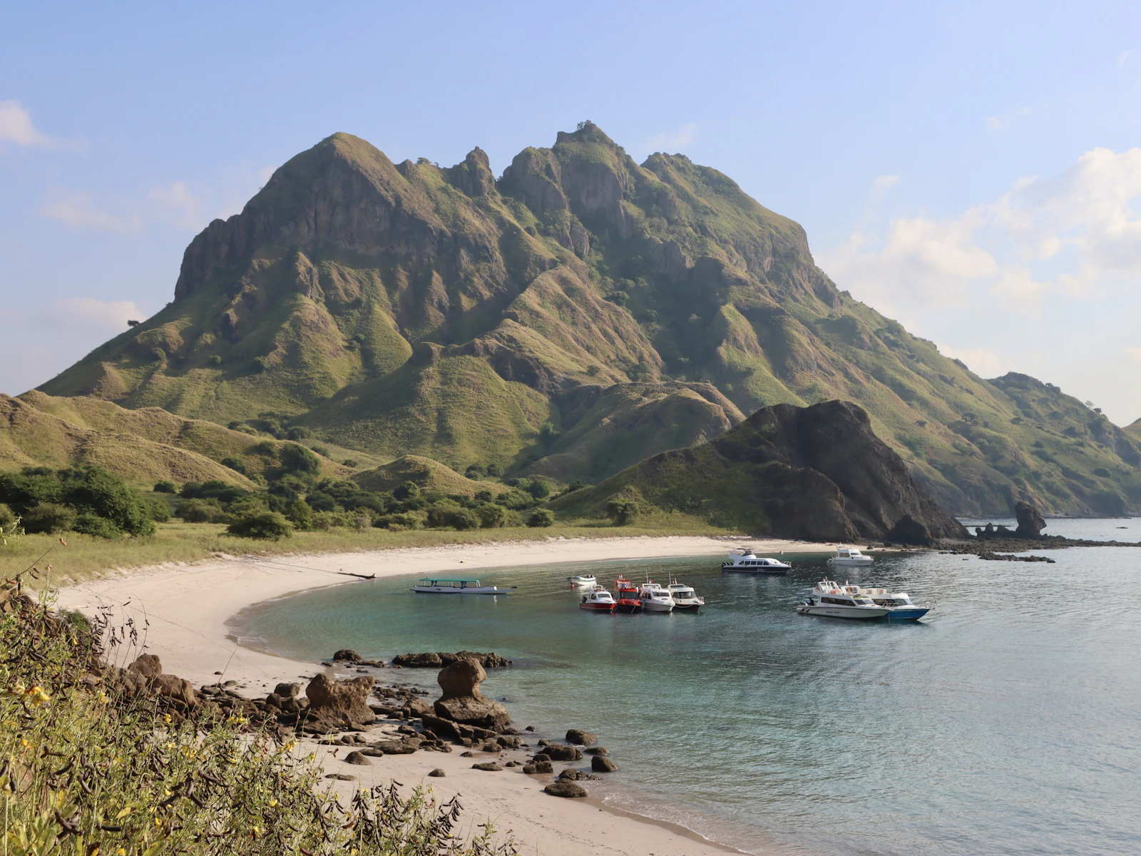
Reaching the final viewpoint is an experience that redefines your understanding of a coastal landscape. The reward for the strenuous climb is a vista of almost surreal beauty, a geological masterpiece that has graced countless magazine covers for good reason. From this vantage point, the unique topography of Padar Island unfolds. You are standing on a narrow saddle, with dramatic bays curving away on either side. It is here that you witness the celebrated trio of beaches, each with its own distinct coloration. To one side lies a stretch of brilliant white sand. Directly ahead, another bay is filled with sand of a deep, volcanic black. And to the other side, the most famous of the three: a beach with a soft, pink hue. This remarkable coloration is not a trick of the light. As detailed by geologists studying the region, the black sand is composed of eroded volcanic minerals like basalt. The pink sand, a phenomenon found in only a few locations worldwide, derives its color from the crushed remains of red organ-pipe coral (Tubipora musica) and microscopic organisms called Foraminifera, which wash ashore and mix with the fine white sand. The view is a powerful lesson in the dynamic forces that shape our planet. This entire area is part of the Komodo National Park, a UNESCO World Heritage site since 1991, recognized for its exceptional natural beauty and its role as a refuge for a relict species. The park encompasses 29 volcanic islands and a total marine and land area of over 1,733 square kilometers, and from Padar’s peak, you can see the distant, rugged shores of Komodo and Rinca islands, completing a 360-degree panorama of this ancient world.
Strategic Timing: When to Conquer the Padar Island Hike Route
The timing of your hike is the single most critical factor influencing your experience, second only to the weather itself. There are two golden windows for the ascent: sunrise and sunset. A sunrise hike is the preferred option for most photographers and those sensitive to heat. This requires an early departure, often around 4:00 AM from Labuan Bajo, to reach the island’s jetty before the first light. The primary advantage is the temperature; you’ll be climbing in the relative cool of the pre-dawn, with the sun only beginning to assert its strength as you reach the summit. The soft, angled light of the rising sun illuminates the landscape dramatically, creating long shadows that accentuate the island’s contours.
Conversely, a sunset hike offers a different, equally compelling spectacle. The afternoon ascent is undeniably hotter and more demanding, but the payoff is the view of the sun dipping below the horizon, bathing the entire archipelago in a fiery, golden glow. The descent in the growing twilight adds a layer of adventure. The choice between the two often depends on your boat’s itinerary. Beyond the time of day, the season plays a crucial role. The dry season, from April to November, guarantees clearer skies and less chance of rain, but the landscape will be a palette of ochre and brown. The rainy season, from December to March, transforms the hills into a vibrant, almost impossibly green spectacle. However, the risk of tropical downpours increases, which can make the stone steps slippery and hazardous. Late April through June is commonly cited by Labuan Bajo boat operators as the sweet spot: the islands are still lush from the rains, while the dry season’s stable weather has largely arrived. Planning your trip during this period can significantly impact your budget; for more on this, our Padar Island Pricing & Cost Guide provides a detailed breakdown.
Gearing Up: An Editor’s Essential Packing List
Approaching the Padar Island hike route requires thoughtful preparation. While it is not a technical climb, the combination of a steep incline and the equatorial climate demands specific gear for both safety and comfort. Footwear is paramount. Visitors regularly attempt the climb in simple flip-flops, a decision that often ends in slips or discomfort. The ideal choice is a pair of trail runners or hiking sandals with substantial grip and closed toes to protect against the sharp volcanic rock. Brands like Keen or Merrell are perfectly suited for this terrain. Hydration cannot be overstressed. The heat and humidity, even in the early morning, will cause you to perspire heavily. A minimum of 1.5 liters of water per person is a sensible baseline. It is critical to remember that there are no facilities or vendors on the island itself; you must bring all provisions with you. Sun protection is the next non-negotiable item. The UV index in this part of the world can be extreme, often exceeding 11. A high-SPF, water-resistant sunscreen, a wide-brimmed hat, and polarized sunglasses are essential. For apparel, opt for lightweight, moisture-wicking fabrics. From a photographic standpoint, a wide-angle lens (16-35mm range on a full-frame camera) is ideal for capturing the sweeping panorama from the summit.
Drone operators should be aware that flying within Komodo National Park requires a special, costly permit obtained in advance. For a more exhaustive look at planning your visit, our Definitive Padar Island Guide covers everything from local culture to marine life.
Logistics and Access: Navigating Your Journey to Padar
Padar Island is uninhabited and accessible only by sea, making the journey itself part of the adventure. The sole departure point for all excursions is the bustling harbor town of Labuan Bajo on the western tip of Flores. From there, you have several options, each catering to a different travel style and budget.
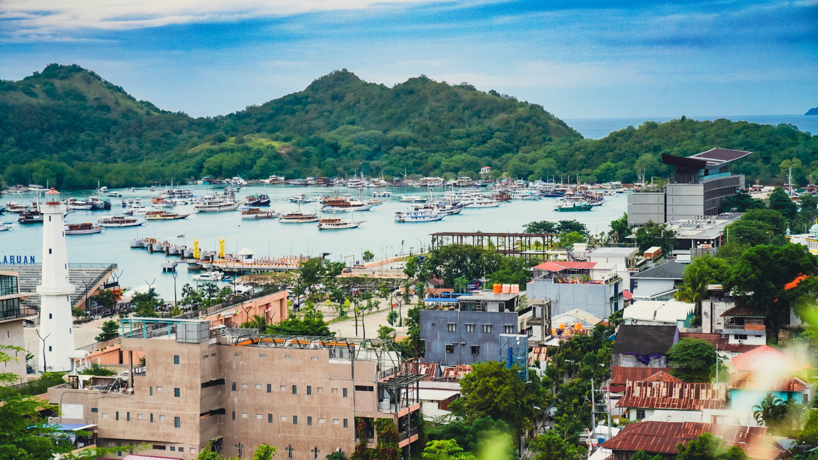
The most exclusive and flexible option is a private speedboat charter. This allows you to dictate your own schedule, avoiding the peak crowds and timing your hike perfectly for sunrise or sunset. A full-day charter for a group can range from $800 to over $2,000 USD, depending on the vessel’s size and amenities. A more common approach is joining a shared tour, either on a speedboat or a more traditional wooden phinisi boat. These tours typically run on a fixed itinerary that includes Padar, Pink Beach, and a stop at Komodo or Rinca Island to see the dragons. The journey from Labuan Bajo to Padar takes roughly 60-120 minutes by speedboat and 2-3 hours or more by a slower wooden boat. Beyond the boat charter, all visitors must pay Komodo National Park fees. As of 2026, it involves a daily entrance ticket (IDR 250,000/day for foreign visitors, IDR 50,000/day (weekdays) or IDR 75,000/day (Sundays & national holidays) for Indonesian citizens), no verified per-person harbor fee, and a separate ranger/guide fee, though Indonesian citizens (WNI) pay a higher rate on Sundays and national holidays than on weekdays, per the official PP No. 36/2024 schedule — see our dated entrance fee breakdown for the current figures. Combine the three layers and a foreign visitor pays roughly IDR 400,000–525,000 per person per day — the PNBP ticket, about IDR 150,000 in ranger/guide fee for every group of 1–5, and bundled conservation and jetty charges (as of August 2026). For official government information, the Indonesia.travel portal is a useful resource. To simplify this process, Komodo Luxury — the operator this guide refers bookings to — publishes its current Padar departures and charter packages, summarised in the boat trip and charter guide.
Quick FAQ: Your Padar Island Hike Route Questions Answered
How difficult is the Padar Island hike?
The hike is rated as moderately difficult. The primary challenges are not technical but environmental: the steep, continuous climb up approximately 800–840 stone steps (no official count published) and the intense equatorial heat. It requires a solid baseline of cardiovascular fitness. The total elevation gain is roughly 170–270 m over a short distance, making for a very condensed effort. Individuals with mobility issues or heart conditions should consult their doctor before attempting it.
Are there Komodo dragons on Padar Island?
Komodo dragons do still occur on Padar Island, but only as a very small, sparse population that visitors effectively never encounter — a 2004 Komodo Survival Program survey recorded at least a dozen individuals, including a hatchling. Historical overhunting of the Timor deer prey base is why the island cannot support the dense, visible numbers found on its neighbours. To see the world’s largest lizard, you must visit the neighboring islands of Rinca or Komodo, which are standard stops on most regional boat tours.
Can I fly a drone on Padar Island?
Flying a drone anywhere within the Komodo National Park, including over Padar Island, is strictly regulated and requires a special permit. These permits must be arranged well in advance through the park authority (Balai Taman Nasional Komodo) and come with a substantial fee, often running several hundred US dollars per day. Unauthorized drone use is met with severe fines and confiscation of equipment.
What are the total park fees for the hike?
The fee structure is complex and subject to change. It is not a single ticket but a collection of levies. Visitors typically pay a park entrance fee, a regional government retribution fee, a conservation fund fee, a ranger fee per group, and a specific activity fee for hiking. For a complete and current breakdown of these expenses, we recommend consulting our detailed Padar Island Pricing & Cost Guide.
The ascent of Padar is more than a physical challenge; it is a right of passage for any traveler exploring the Komodo archipelago. It is a journey that connects you to the raw, volcanic power of this land and rewards you with a perspective that is truly singular. The image of the three colored bays, framed by the rugged, savannah-like hills, will remain etched in your memory long after the muscle soreness fades. The ancient, dramatic landscapes of the Lesser Sunda Islands await. To begin charting your own journey to this geological masterpiece, explore the bespoke travel options available on Padar Island, and let the ascent begin.
After the trail description, the practical part
padarisland.com documents the route; it does not run trips. The boats are our affiliated operator’s, Komodo Luxury. The staircase is free to climb once you are standing on the beach — the paid part of this day is entirely the crossing. Ways to arrange that crossing: Komodo sailing trips, Labuan Bajo tours, and private-trip packages.
What the trail is like underfoot
Padar is volcanic in origin — part of the same ancient arc that formed Komodo and the neighbouring islands — but you experience that as weathered lava and rugged ridges rather than a cone. There is no crater to visit and no current activity; the volcano is geological background, not a hazard.
The climb is consistently steep with steps stacked in quick succession, and you are ascending almost the whole way from the jetty to the ridge, broken only by a few short landings. The main viewpoints sit roughly 170–270 metres above sea level depending on how far along the ridge you walk, and because the trail starts at the beach that figure is both the elevation gain and the height you end up at. Substantial, but not mountainous — the difficulty is the gradient and the heat rather than the distance.
The staircase and ridge path are generally wide enough for two people to pass with care, with a few genuine pinch points and railings along many but not all of the exposed sections. Bottlenecks form wherever a group stops for photographs. Step aside for descending hikers where you can, and do not push past anyone on the steeper, gravelly corners.
Most people take 25 to 45 minutes up depending on fitness, heat and how often they stop to shoot. The descent is usually quicker and harder on the knees. Allow extra margin in a large group, where pauses accumulate, and keep an eye on the clock — boat schedules and session times mean you cannot linger indefinitely at the top.
Where to stop, and when to climb
Three stopping points define the route in practice: a lower terrace over one bay, a mid-level platform where the three inlets begin to line up, and the upper ridge where the island’s trident shape resolves fully. All of them sit on the same spine of steps and dirt trail from the jetty, so every terrace you reach rewards you even if you stop there, and rangers generally prefer brief pauses spread across several signed points to everyone crowding the final ridge. They may also steer you to slightly different angles depending on crowding or trail maintenance on the day.
The gap between the mid-level terraces and the highest ridge is only a fraction of the total height, but in that heat the extra effort feels disproportionate. Stopping where you are comfortable and still taking home a strong panorama is a perfectly sound decision, particularly with older knees or younger children in the party.
Early morning and late afternoon are the comfortable windows, with softer light and lower temperatures; midday is harsher because there is no shade and the stone radiates heat. Within the session system, the earliest slot gives the quietest ascent and the best chance of cool air. Dry-season months tend to deliver clearer horizons, the wet season more dramatic cloud and greener hills — weigh that against your tolerance for rougher crossings.
Is it worth it? Most visitors say yes, on the basis that the bays and ridgelines genuinely unfold as you gain height. The honest trade-off is effort in hot, exposed conditions and sharing the space at peak times, which the earliest and latest sessions largely solve.
Safety, supervision and who should reconsider
With rangers, marked stairs and a defined route, the hike is relatively safe for reasonably fit visitors. The real risks are slips on loose gravel, heat exhaustion and minor scrapes in crowded sections — all reduced by staying on the trail, pacing yourself, wearing proper shoes and following staff instructions.
Whether it feels frightening depends on you. The constructed staircase and railings keep it manageable for most people comfortable with heights, but the upper ridge sections can be intimidating where the ground falls away and groups are jostling for photographs. You can stop lower down, and nobody is obliged to step onto the narrowest promontories.
Walking entirely alone is not how the site is managed. Ranger presence and group control are part of current rules, and they apply even if you arrive by private charter: you climb at your own pace within your session, but routes and turnaround times follow staff direction, side trails are off-limits and drones need special permission. Treat it as supervised access to a protected area rather than a free-roaming trek.
School-age children with some hiking experience usually cope if adults set a slow pace and carry the shared water. Around seven and upward is the realistic threshold for the full climb, provided heights are not an issue and stairs are familiar; younger children are often happier turning back at a lower terrace. The shadelessness and the steepness are what challenge them rather than the distance, so plan more breaks than you would for yourself, name meeting points, keep them close at the upper viewpoints where enthusiasm for photos pulls people toward the edges, and be clear that ranger instructions and roped no-go areas are not negotiable.
Active seniors who handle stairs and moderate hills regularly manage it by going slowly and resting often, with walking poles helping on the less even dirt above the main staircase. There is no vehicle access and no shade shelter anywhere on the route, so anyone with heart, knee or balance issues should talk to their doctor before travelling. If you are bringing older parents who are unaccustomed to steep staircases, showing them photographs of the steps beforehand is the kindest way to let them decide; if they come, carry some of their load, start near the front of your session so you are not rushed, and be ready to turn back early. Encourage the handrails and a rest at every landing, and keep them drinking — sun, humidity and incline together are more tiring than any one of them alone.
There is no wheelchair access and no vehicle-assisted route, so travellers with limited mobility generally focus on boat-based viewing and gentler stops elsewhere in the park. Raise this with operators in advance and they can suggest itineraries built around calm bays and short, flat walks that still keep the island in view.
Do not let “short” mislead you: local warnings about this being a strenuous hike are accurate. High humidity, direct sun and a constant staircase make it feel harder than a longer, gentler trail at home. Pace it like any uphill workout and do not skip water.
What to carry
Closed footwear with real grip, at least one full water bottle, sun protection and a small daypack cover the essentials. A thin towel or scarf doubles as shade at rest stops, snacks help if you tire, a light rain layer earns its place in the wet season, and basic plasters are worth the space. A headlamp matters on sunrise and sunset trips, when parts of the trail are still dim despite ranger supervision. A simple dry bag protects electronics on the crossing. Leave heavy lenses you will not actually use.
Photographers carrying more than one body or lens should plan how they will change them: use a sling or chest bag you can reach while standing still at a landing rather than swapping gear mid-step, and keep one hand free for the rail. For video, a small gimbal or a stabilised action camera handles the staircase best; walk with shorter steps and elbows tucked in, and on a phone use a wrist strap, record at a higher frame rate where you can, and save panning shots for the landings.
Porters are not a formalised service here, unlike some longer Indonesian treks, and there is no published tariff. Most tours expect you to carry your own small pack. If a crew member or local helper informally takes extra bags, it is a tip or a private arrangement — agree the expectation and the cash amount with your organiser beforehand rather than at the jetty.
On cost, the hike carries no separate ticket: you pay through the boat trip and the park charges. For a foreign visitor a Padar day generally lands in the mid-hundreds of thousands of rupiah once transport and mandatory park fees are combined, with the exact total set by the tour you choose. Shared-boat itineraries that pair Padar with nearer snorkelling stops usually beat a bespoke charter on value while giving the same access to the staircase and ridge — the question worth asking is how much time on the island the schedule actually allows.
If Padar is bundled into a wider Komodo itinerary alongside dragon walks and snorkelling, plan your energy across the day. Where the staircase is your priority, ask for an earlier Padar slot and put the water-based activities afterward, when they double as recovery.
Panduan pendakian dalam Bahasa Indonesia: Panduan Lengkap Pulau Padar.
This guide does not operate boats. Bookings are fulfilled by Komodo Luxury, and this site may earn a referral commission.
Ready When You Are
Ready to book?
Chat directly on WhatsApp with the Komodo Luxury team.
This guide does not operate boats. Bookings are fulfilled by Komodo Luxury, and this site may earn a referral commission.